

BENEFITS
ABNA has augmented our Land Surveying skills by adding Drone Technology (Unmanned Aerial System) led by ABNA’s three FAA Licensed Drone Pilots. ABNA’s Drone resume includes clients such as Ameren, Forest Park Forever, BJC, and MoDOT to name a few. Contact us for your next project to show you how ABNA’s Drone Surveying is the perfect application to save time, increase efficiency, and control costs.
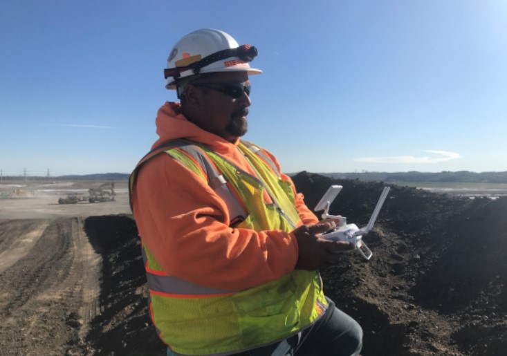
Pictured Above: ABNA’s Licensed Drone Pilot Steve Perry
VALUE ADDED
- Safety/Minimizes Hazardous Areas
- Less Time in Field
- Increased Accuracy
- Aerial LiDAR integration
VARIOUS AREAS
- Heavy Construction Zones
- Long alignments-Rivers, Roadways, Powerlines
- Industrial Facilities
- Large sites
MULTI-DESIGN USES
- Visual Inspections
- Drainage Assessments
- 3D Modeling of Large Structures and Sites
- Ground Control
(1)")
Above: Digital elevation model mapping
Green: Vegetation Features
Red: Higher Elevation
Blue: Lower Elevation
DATA COLLECTION
- Material Quantity Estimations
- Topographic digital elevations
- Aerial Photography
- Videography
- Photogrammetry
- 3D PDFs
- Sharable Data


